We've partnered with Outdooractive
Whilst the ability to use a map and a compass will always be foundational to both the training and qualification – not to mention the reality of being a walk leader – tools and skills evolve – very very few leaders don’t have some sort of mapping software on their phone nowadays.
But – there a huge range of mapping and ‘hiking-guide’ software out there – some of it very good – some of it worryingly bad….
Here at Wellness Walks we want our team to have the best tools to help make them the best leaders possible – so we thought we’d explain why we’ve partnered with Outdooractive.
Outdooractive have been super helpful – and wonderfully they’ve offered all the Wellness Walks Team a free Pro+ (the very top tier) license – initially its for three months – but if we prove we’re using it they’re very keen to extend.
They’re also offering all of our participants a 10euro discount – which equates to about 25%.
The best tool for the job...
Many outdoor instructors will often lament the disappearance of Viewranger – but actually it was bought and integrated into Oudooractive – that’s how we first came to know them.
For a long time in the UK Ordnance Survey (OS) has been the gold standard for mapping – its what most courses are based on, its the best mapping in the world. And we’re a big fan – but the app is sadly quite hard work, and of course it’s designed to (mainly) use OS maps. But nowadays a lot of other maps are available, are often easier (or at least more appropriate) to use.
Outdooractive are a huge organisation with a global reach – and it shows in the quality of the software and the range of options they have available.
Why different Maps are a benefit...
There are lots of reasons you might want to look at, or use, a different map.
OS have mapping for every single part of the UK – its reliable, a gold-standard product and it’s been around so long that we’re all familiar with it (to some level) – so any app or software we use has to have it. It’s included in Outdooractive.
But for some people – myself included, OS maps can seem a little ‘busy’; in mountain areas the contours can overwhelm – so for a long time my map of choice has been a Harveys map – ground is colour coded and easy to ‘immediately’ see, contours are 15m so features are more striking etc. Harveys Maps are included in Outdooractive Pro+.
But – once I started to use the app I realised there are lots of maps (& if I go overseas it also works there…) and actually that can be a huge real-world benefit.
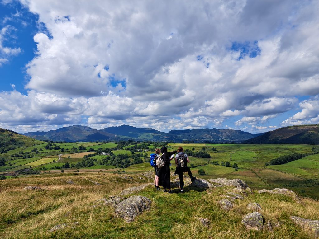
Many of our Wellness Walks volunteers are Lowland Leaders – and a key factor is being on a ‘path’ that’s both visible on the ground AND the map. On a recent course in the Scottish Highlands the following three pictures told a very interesting story. On our journey we came to a large track – quite close to our target – but not quite right….
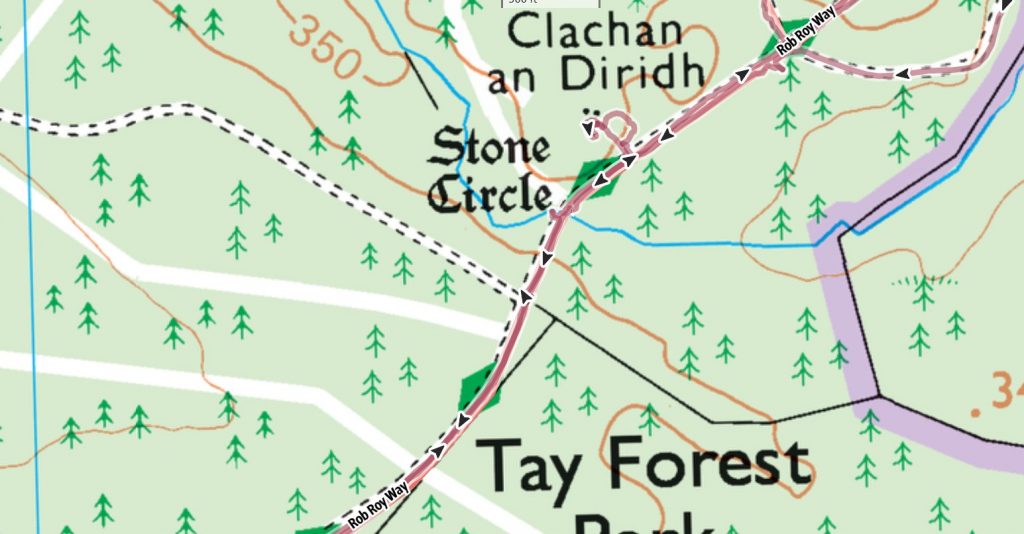
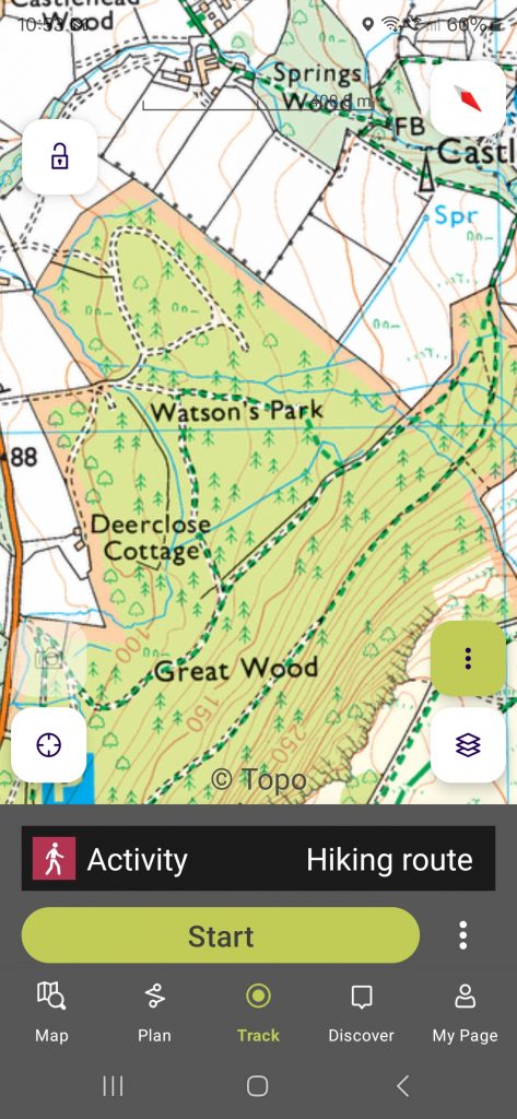
OS 1:25,000 map shows a T junction and boundary….
But we were definitely at a crossroads on a national trail, hmmmm.
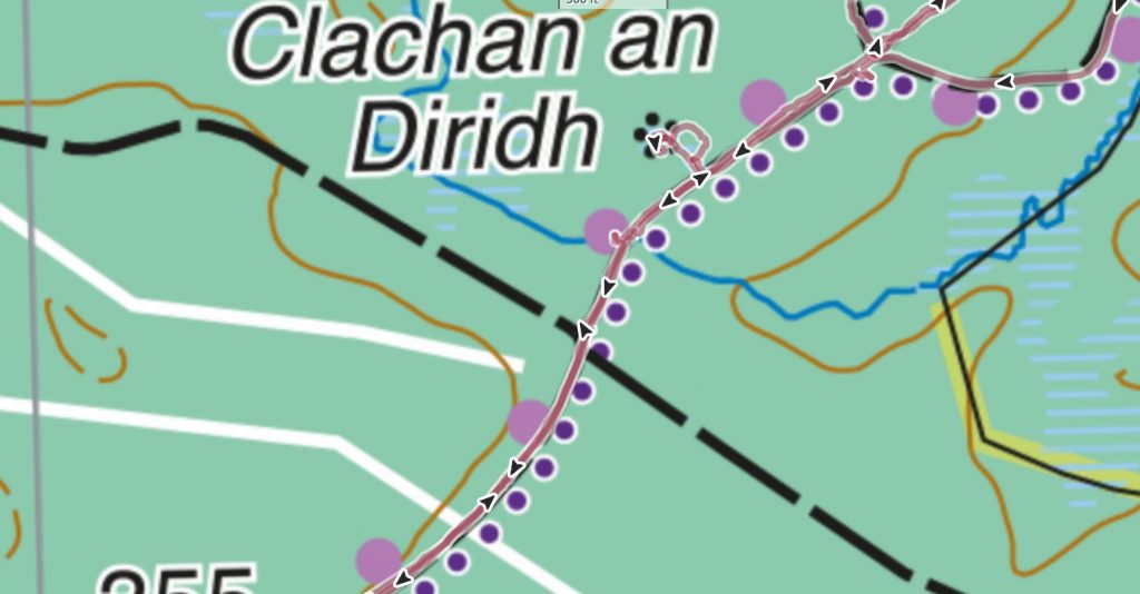
Harveys 1:40,000 map showed a path or bridleway crossing us…
but this was a big, vehicle sized track….
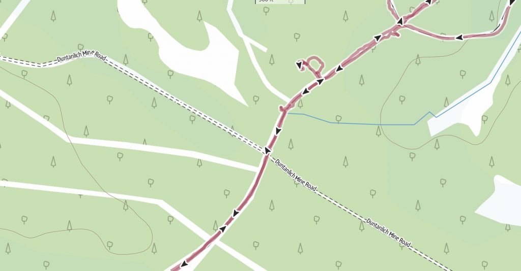
This ‘open’ map level showed a named road…
Now we’re not always a fan of open access mapping as we’re never 100% sure how its validated – but it does often have much better localised knowledge. We confirmed where we were by pacing to the stream – and suddenly it all made sense again.
How easy is it to use...
Very – over the quieter winter months we’ll be uploading some ‘how to’ videos – but so far its the best interface we’ve come across.
Recording a track is super simple – and seems to use very little battery life compared to other apps I’ve used – I was able to record a six hour route in and out of trees in the Lake District and it used less than 15% of my Samsung S24 battery (only glanced at occasionally).
I quite often like to record tracks for notes later or participant feedback – it’s something that’s proven surprisingly difficult on other apps – on Outdooractive its literally two clicks, and I particularly like that I can hide the track to see the map better.
What else has impressed us?...
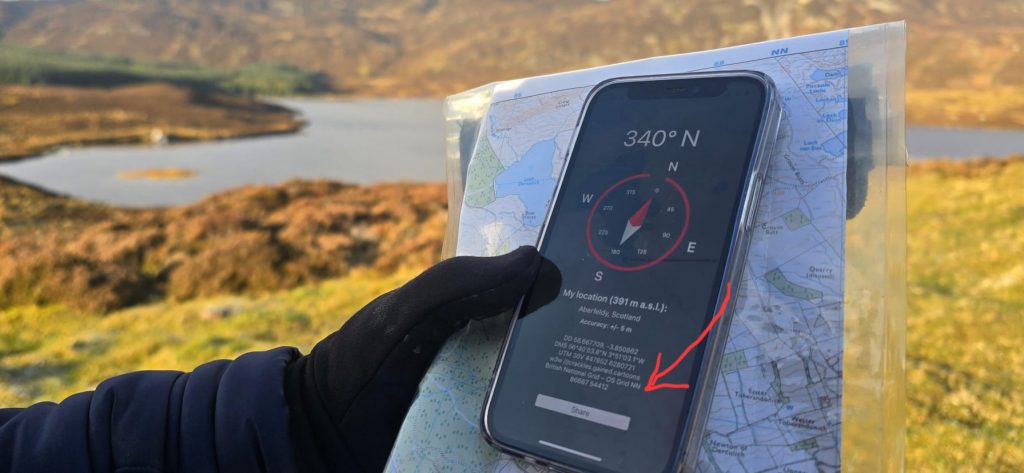
If you press the little compass icon on the top right of the screen then a fantastic screen comes up with co-ordinates, (the dreaded, but useful in towns) What 3 Words and a UK Grid Reference.
Super useful.
Conclusion
Map and compass will always be our basics – but as skills evolve – if we want an exceptional experience for our beneficiaries and course candidates – then understanding and using the best tools is obvious.
We’ll be adding more top tips and videos as we learn more about Outdooractive and as they continue to add features.
Sharing is caring!